
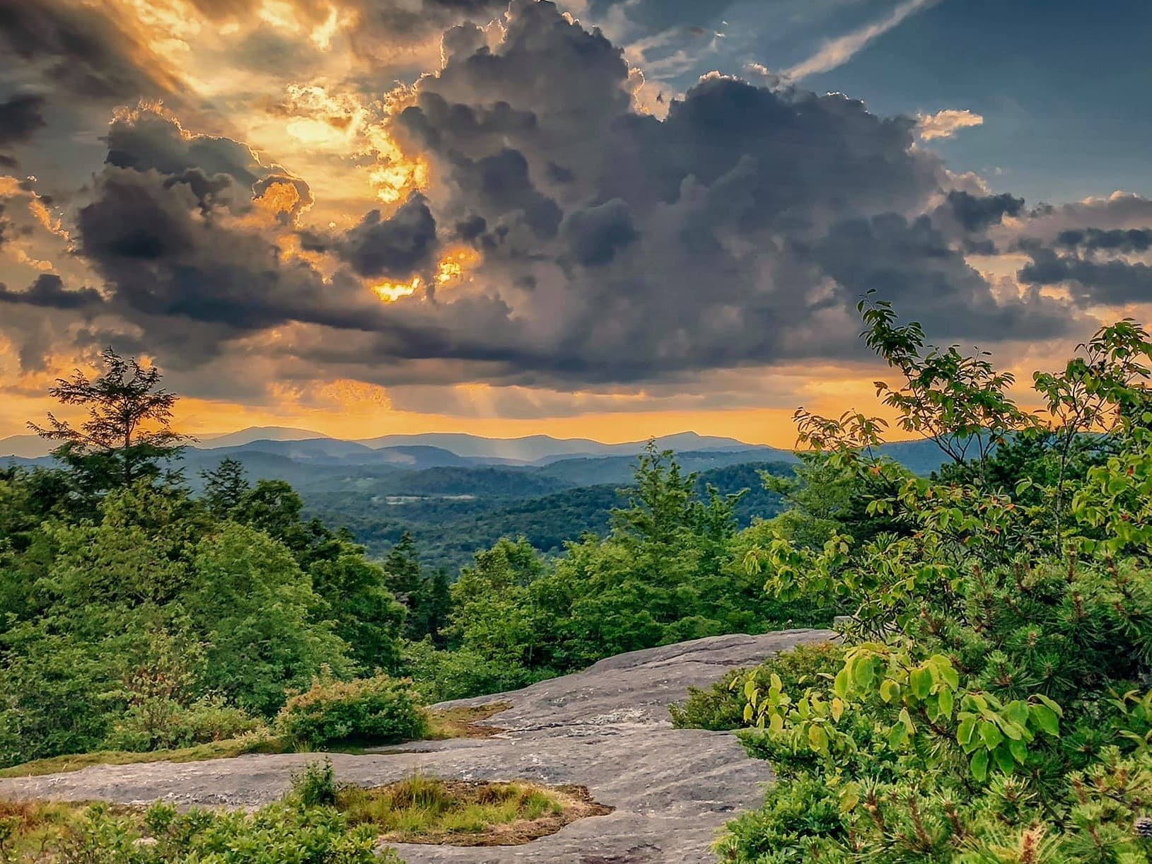
Grove Park/Cherokee Road
A brisk 3.2 mile neighborhood walk from Sunset Park through the Albemarle Park historic district and up Cherokee Road, mixing gradual climbs with a few steep sections. Expect 604 ft elevation gain, ~2.8 mph pace, and mountain-view streetscapes.
Similar Events

A 3 mile neighborhood loop from Kenilworth Park through Caledonia and Ravenna, passing the Kenilworth Inn with views toward Swannanoa. Short but hilly route with about 417 ft of elevation gain in roughly 1 hour 20 minutes.
A 3 mile neighborhood loop from Kenilworth Park through Caledonia and Ravenna, passing the Kenilworth Inn with views toward Swannanoa. Short but hilly route with about 417 ft of elevation gain in roughly 1 hour 20 minutes.
A 3 mile neighborhood loop from Kenilworth Park through Caledonia and Ravenna, passing the Kenilworth Inn with views toward Swannanoa. Short but hilly route with about 417 ft of elevation gain in roughly 1 hour 20 minutes.

A moderate 5 mile road loop around Murdock Grove and Weaver Blvd at a steady 3.2 mph pace with about 800 feet of elevation gain. Leashed dogs are welcome, and the Scenic Asheville series counts toward a badge challenge.
A moderate 5 mile road loop around Murdock Grove and Weaver Blvd at a steady 3.2 mph pace with about 800 feet of elevation gain. Leashed dogs are welcome, and the Scenic Asheville series counts toward a badge challenge.
A moderate 5 mile road loop around Murdock Grove and Weaver Blvd at a steady 3.2 mph pace with about 800 feet of elevation gain. Leashed dogs are welcome, and the Scenic Asheville series counts toward a badge challenge.

A guided 4 mile walk from the Montford Visitor Center weaves through historic Montford and into downtown Asheville on mostly paved terrain with a few hills. Designed for active retirees, with free parking, restrooms, and a no dogs policy.
A guided 4 mile walk from the Montford Visitor Center weaves through historic Montford and into downtown Asheville on mostly paved terrain with a few hills. Designed for active retirees, with free parking, restrooms, and a no dogs policy.
A guided 4 mile walk from the Montford Visitor Center weaves through historic Montford and into downtown Asheville on mostly paved terrain with a few hills. Designed for active retirees, with free parking, restrooms, and a no dogs policy.
Evening lakeside stroll on a gentle loop with local guides, featuring calm water views, boardwalk sections, and interpretive commentary plus chances for wildlife spotting and nature photography.
Evening lakeside stroll on a gentle loop with local guides, featuring calm water views, boardwalk sections, and interpretive commentary plus chances for wildlife spotting and nature photography.
Evening lakeside stroll on a gentle loop with local guides, featuring calm water views, boardwalk sections, and interpretive commentary plus chances for wildlife spotting and nature photography.

Moderate-paced Mountains-to-Sea Trail hike on a narrow, undulating route with rocky steps early and a rooty tread most of the way, plus a short climb around the 2.5-mile mark. Leashed, well-behaved dogs welcome for a fitness-focused group outing from the Craven Gap gravel lot.
Moderate-paced Mountains-to-Sea Trail hike on a narrow, undulating route with rocky steps early and a rooty tread most of the way, plus a short climb around the 2.5-mile mark. Leashed, well-behaved dogs welcome for a fitness-focused group outing from the Craven Gap gravel lot.
Moderate-paced Mountains-to-Sea Trail hike on a narrow, undulating route with rocky steps early and a rooty tread most of the way, plus a short climb around the 2.5-mile mark. Leashed, well-behaved dogs welcome for a fitness-focused group outing from the Craven Gap gravel lot.
A brisk 5–5.5 mile Bent Creek hike starting at the Rice Pinnacle parking area, moving at a steady 2.7–3 mph. Expect one midway water break and a finish around 10:50–11:00 p.m. depending on distance.
A brisk 5–5.5 mile Bent Creek hike starting at the Rice Pinnacle parking area, moving at a steady 2.7–3 mph. Expect one midway water break and a finish around 10:50–11:00 p.m. depending on distance.
A brisk 5–5.5 mile Bent Creek hike starting at the Rice Pinnacle parking area, moving at a steady 2.7–3 mph. Expect one midway water break and a finish around 10:50–11:00 p.m. depending on distance.

A morning group walk meeting at Antler Hill Pavilion near the playground, heading out on Biltmore’s mostly flat Farm Trail along the French Broad River. If trail closures persist, the route shifts to the shorter Lagoon Trail starting from the same spot.
A morning group walk meeting at Antler Hill Pavilion near the playground, heading out on Biltmore’s mostly flat Farm Trail along the French Broad River. If trail closures persist, the route shifts to the shorter Lagoon Trail starting from the same spot.
A morning group walk meeting at Antler Hill Pavilion near the playground, heading out on Biltmore’s mostly flat Farm Trail along the French Broad River. If trail closures persist, the route shifts to the shorter Lagoon Trail starting from the same spot.

A relaxed Tuesday evening wander through spring-blooming arboretum gardens and easy trails, then settling into a scenic spot for Blue Ridge sunset views. Casual social hang as the sky shifts to gold and pink.
A relaxed Tuesday evening wander through spring-blooming arboretum gardens and easy trails, then settling into a scenic spot for Blue Ridge sunset views. Casual social hang as the sky shifts to gold and pink.
A relaxed Tuesday evening wander through spring-blooming arboretum gardens and easy trails, then settling into a scenic spot for Blue Ridge sunset views. Casual social hang as the sky shifts to gold and pink.

A mellow evening stroll through the Beaver Lake Bird Sanctuary boardwalk loop followed by a two mile lake trail walk. Rain or shine plans create a low pressure, nature focused meetup for quiet connection.
A mellow evening stroll through the Beaver Lake Bird Sanctuary boardwalk loop followed by a two mile lake trail walk. Rain or shine plans create a low pressure, nature focused meetup for quiet connection.
A mellow evening stroll through the Beaver Lake Bird Sanctuary boardwalk loop followed by a two mile lake trail walk. Rain or shine plans create a low pressure, nature focused meetup for quiet connection.

A relaxed spring stroll along arboretum garden trails at an easy, conversational pace with scenic blooms and mountain views. The morning wraps with a casual coffee hang at the on site Arbor Eatery, ideal for meeting other locals.
A relaxed spring stroll along arboretum garden trails at an easy, conversational pace with scenic blooms and mountain views. The morning wraps with a casual coffee hang at the on site Arbor Eatery, ideal for meeting other locals.
A relaxed spring stroll along arboretum garden trails at an easy, conversational pace with scenic blooms and mountain views. The morning wraps with a casual coffee hang at the on site Arbor Eatery, ideal for meeting other locals.
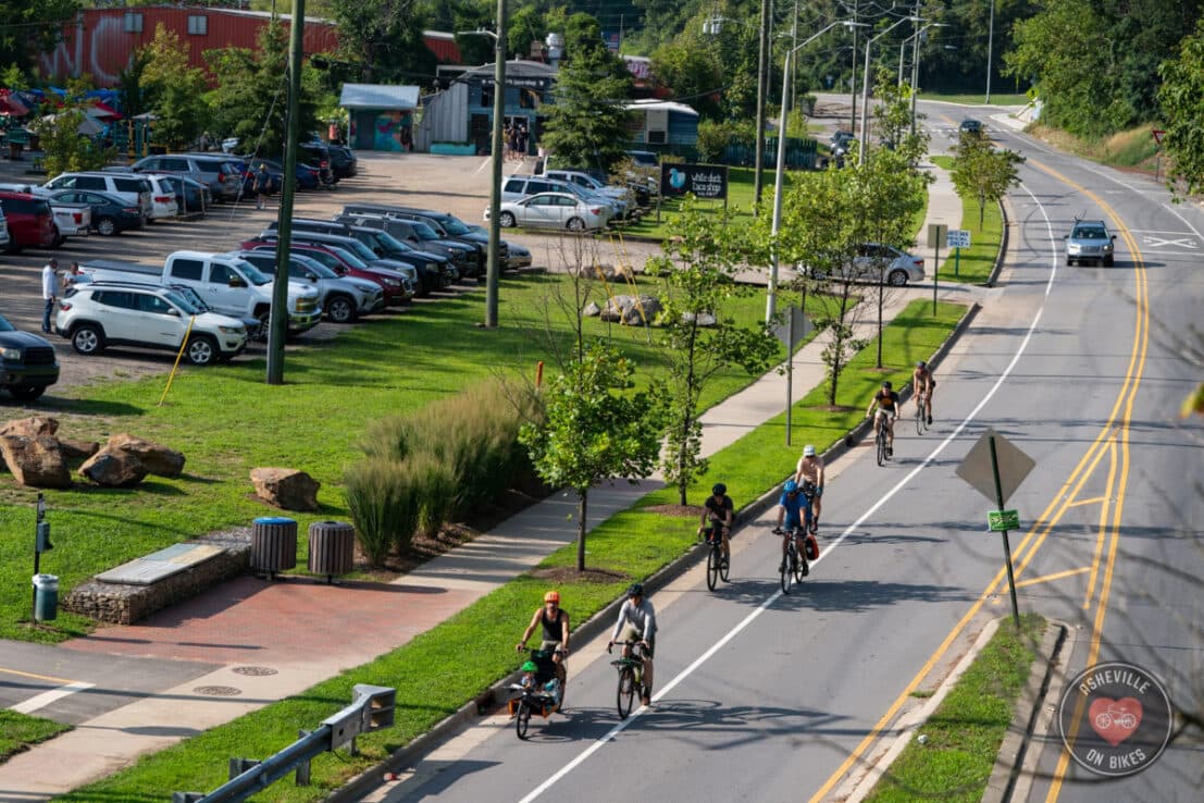
Social no-drop road ride through Asheville neighborhoods covering 10 to 14 miles with roughly 1000 ft of climbing, paced for mixed abilities and ending at a local doughnut shop for coffee and pastries.
Social no-drop road ride through Asheville neighborhoods covering 10 to 14 miles with roughly 1000 ft of climbing, paced for mixed abilities and ending at a local doughnut shop for coffee and pastries.
Social no-drop road ride through Asheville neighborhoods covering 10 to 14 miles with roughly 1000 ft of climbing, paced for mixed abilities and ending at a local doughnut shop for coffee and pastries.

A brisk sober curious coffee walk through the River Arts District with a 3–4 mile loop over Haywood Bridge to the former French Broad Park area, then back via Craven St Bridge. Meet at Summit Coffee; punctual start and active construction along the route.
A brisk sober curious coffee walk through the River Arts District with a 3–4 mile loop over Haywood Bridge to the former French Broad Park area, then back via Craven St Bridge. Meet at Summit Coffee; punctual start and active construction along the route.
A brisk sober curious coffee walk through the River Arts District with a 3–4 mile loop over Haywood Bridge to the former French Broad Park area, then back via Craven St Bridge. Meet at Summit Coffee; punctual start and active construction along the route.
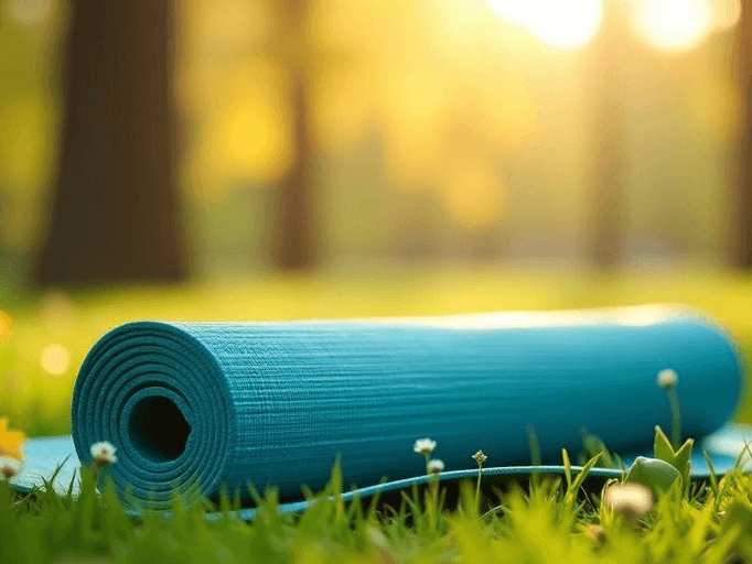
A sunset yoga flow set on the grass in Montford Park, pairing gentle movement and breathwork with open-sky views. Ideal for all levels looking for an outdoor reset and relaxed evening energy.
A sunset yoga flow set on the grass in Montford Park, pairing gentle movement and breathwork with open-sky views. Ideal for all levels looking for an outdoor reset and relaxed evening energy.
A sunset yoga flow set on the grass in Montford Park, pairing gentle movement and breathwork with open-sky views. Ideal for all levels looking for an outdoor reset and relaxed evening energy.
Fast-paced road training ride covering 45 to 50 miles at a brisk group tempo, with an occasional B group for slightly slower riders. Not a guaranteed no-drop outing—expect a challenging, experienced-rider pace.
Fast-paced road training ride covering 45 to 50 miles at a brisk group tempo, with an occasional B group for slightly slower riders. Not a guaranteed no-drop outing—expect a challenging, experienced-rider pace.
Fast-paced road training ride covering 45 to 50 miles at a brisk group tempo, with an occasional B group for slightly slower riders. Not a guaranteed no-drop outing—expect a challenging, experienced-rider pace.

A moderate 5-mile out-and-back on the Mountain-to-Sea Trail from Craven Gap, crossing the Parkway and rolling through newly reopened terrain reshaped by Hurricane Helene. Midpoint break at 2.5 miles before returning the same route.
A moderate 5-mile out-and-back on the Mountain-to-Sea Trail from Craven Gap, crossing the Parkway and rolling through newly reopened terrain reshaped by Hurricane Helene. Midpoint break at 2.5 miles before returning the same route.
A moderate 5-mile out-and-back on the Mountain-to-Sea Trail from Craven Gap, crossing the Parkway and rolling through newly reopened terrain reshaped by Hurricane Helene. Midpoint break at 2.5 miles before returning the same route.
Easy pace group ride through Asheville neighborhoods ending at a local cafe for coffee; Asheville on Bikes hosts a social, all levels bike meetup focused on community connection and casual conversation.
Easy pace group ride through Asheville neighborhoods ending at a local cafe for coffee; Asheville on Bikes hosts a social, all levels bike meetup focused on community connection and casual conversation.
Easy pace group ride through Asheville neighborhoods ending at a local cafe for coffee; Asheville on Bikes hosts a social, all levels bike meetup focused on community connection and casual conversation.
Historian-led walk through downtown Asheville, unpacking key sites, stories, and architectural details with context-rich local history. Starts from a Patton Avenue bar and coffee shop for an easy meet-up point.
Historian-led walk through downtown Asheville, unpacking key sites, stories, and architectural details with context-rich local history. Starts from a Patton Avenue bar and coffee shop for an easy meet-up point.
Historian-led walk through downtown Asheville, unpacking key sites, stories, and architectural details with context-rich local history. Starts from a Patton Avenue bar and coffee shop for an easy meet-up point.
Brisk A-paced social road ride of about 30 miles with a drop format; groups split into two when 20+ riders and the route is available on RideWithGPS—check in if you're unfamiliar with local roads.
Brisk A-paced social road ride of about 30 miles with a drop format; groups split into two when 20+ riders and the route is available on RideWithGPS—check in if you're unfamiliar with local roads.
Brisk A-paced social road ride of about 30 miles with a drop format; groups split into two when 20+ riders and the route is available on RideWithGPS—check in if you're unfamiliar with local roads.
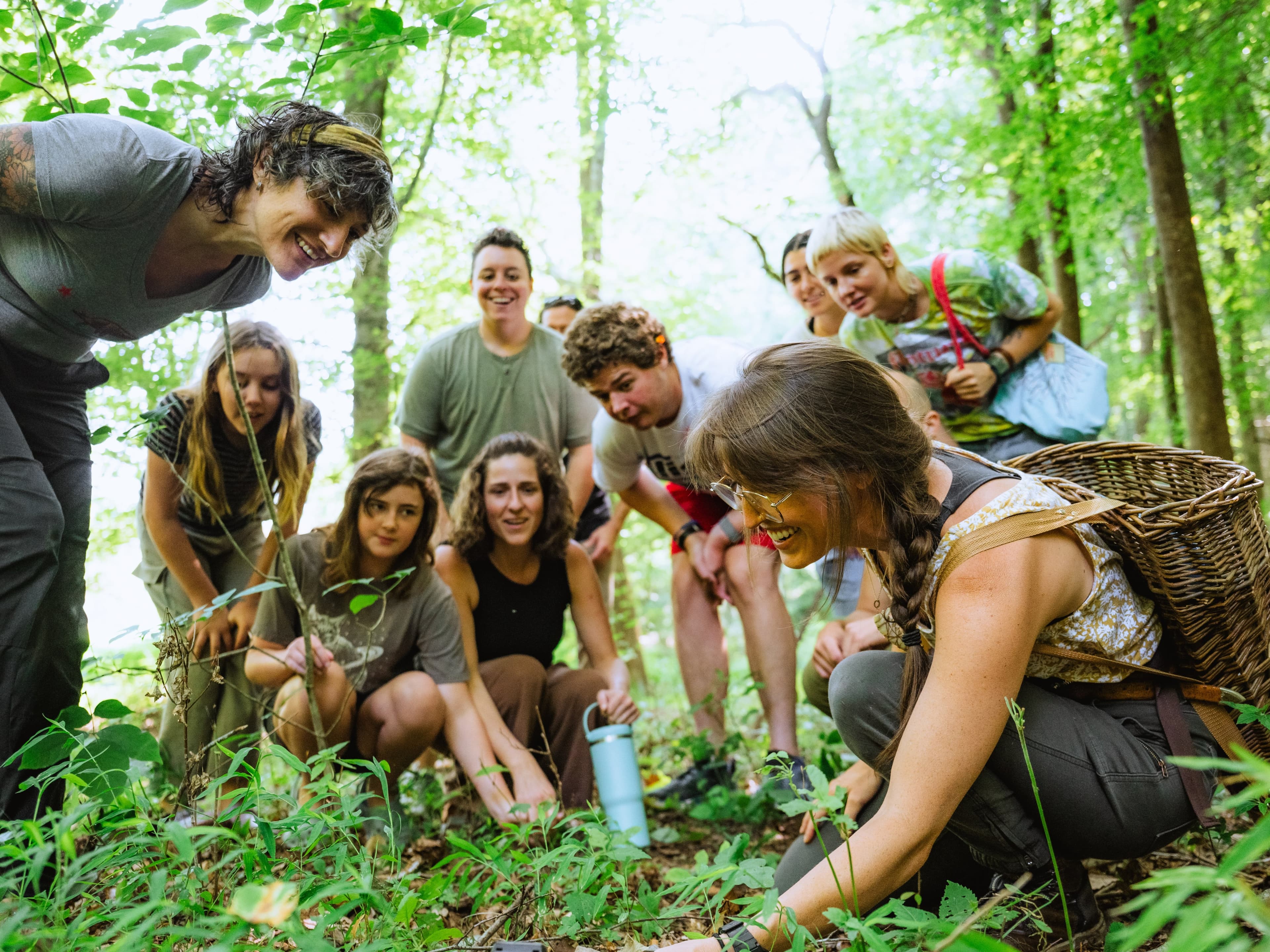
Guided neighborhood foraging walks identifying spring wild edibles—greens, mushrooms, and berries—emphasizing sustainable harvesting, plant ID, and seasonal recipes. Casual outdoor stroll welcoming beginners and curious eaters.
Guided neighborhood foraging walks identifying spring wild edibles—greens, mushrooms, and berries—emphasizing sustainable harvesting, plant ID, and seasonal recipes. Casual outdoor stroll welcoming beginners and curious eaters.
Guided neighborhood foraging walks identifying spring wild edibles—greens, mushrooms, and berries—emphasizing sustainable harvesting, plant ID, and seasonal recipes. Casual outdoor stroll welcoming beginners and curious eaters.

A hilly 3-mile or 5-mile neighborhood group run through Kenilworth with turns onto Lakewood, Waverly, and Kenilworth Road. Cool down back at the brewery for a social post-run hang and fresh pints.
A hilly 3-mile or 5-mile neighborhood group run through Kenilworth with turns onto Lakewood, Waverly, and Kenilworth Road. Cool down back at the brewery for a social post-run hang and fresh pints.
A hilly 3-mile or 5-mile neighborhood group run through Kenilworth with turns onto Lakewood, Waverly, and Kenilworth Road. Cool down back at the brewery for a social post-run hang and fresh pints.